SUNOL REGIONAL WILDERNESS
Flag Hill to Indian Joe Creek Loop | Sunol, CA
★★★★☆
Steep climbs that yield to scenic panoramas, followed by a dreamy creekside stroll across the tranquil canyon floor.
Last hiked 12/31/20
Length: 5.7 mi.
Gain: 1290 ft.
Type: Loop
Difficulty: Strenuous
Crowds: Low
Dogs: Yes. $2 per dog; free for service dogs


THE RUNDOWN
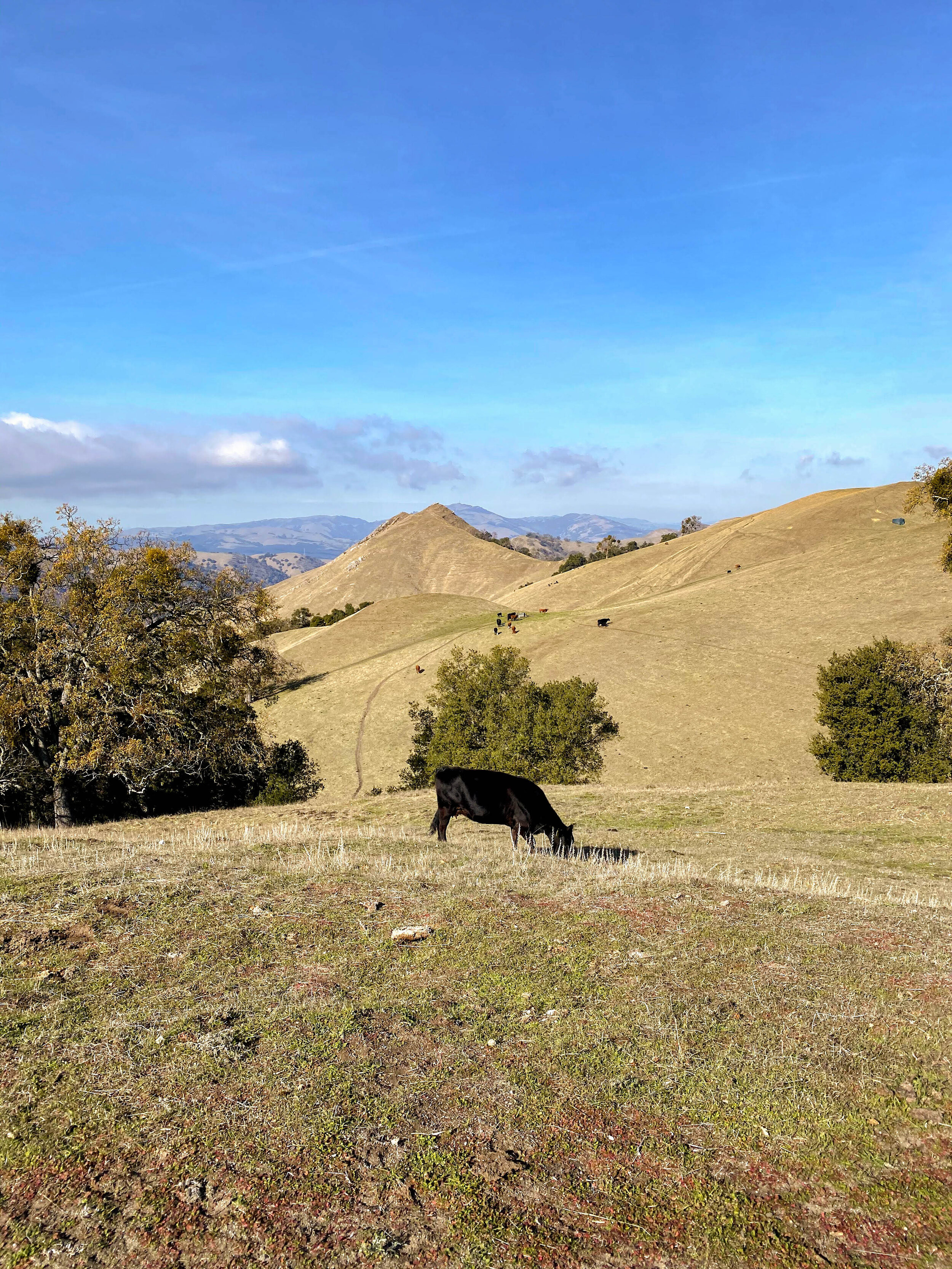
If you’ve ever driven in the East Bay, you may have noticed the long chain of smooth, rolling hills rising above the suburbs towards the east. Sunol Regional Wilderness embodies this landscape, with one exception - Flag Hill. A workout of a climb up a trapezoidal-looking mountain marked with grazing cows makes you feel like you’re truly on top of the world.
There are a few parking lots near the trailhead. We recommend getting there before 9:30 to secure a spot at the lot directly adjacent to the trailhead. Overflow options include one lot across the street and another by the Visitor Center. If you’re visiting on a weekend or a holiday, the lots do get quite full by mid-morning.
Park Hours: 8am to dusk
Fees: $5 per car + $2 per dog (free for service dogs)
Trailhead: Across the footbridge at Canyon View Trailhead
Restroom: Yes
Park at the first parking lot after the fee station at the end of Geary Road. Park map downloaded from East Bay Regional Park District. Click to enlarge. For the trailhead, look for the footbridge, or signs for Canyon View Trail.
You may think you’ve reached the highest point at Flag Hill, but expect to climb a second time up Eagle View Trail. Don’t worry, it’s well worth it!
Parking is located just beyond the fee station at the end of Geary Road.
STEP BY STEP
↑ Start your hike by crossing the footbridge at Canyon View Trailhead.
← Make a left onto Canyon View Trail, headed towards Flag Hill Trail.
Tip: You may notice an unlabeled trail on the left; pass by and don’t get thrown off by it. You’ll see some trail signs soon.
← At the fork, stay left for Flag Hill Trail.
Optional: Once you reach the top of Flag Hill Trail, you may additionally take Flag Hill Loop to fully enjoy the summit views.
→ Make a right onto Flag Hill Road.
Note: Here, you’ll descend quickly in preparation for another climb.
↑ Continue straight onto Vista Grande Road.
Note: The climb begins!
→ Make a right onto Eagle View Trail.
Tip: On first glance, this fork looks like a simple path to a viewpoint with a bench. The trail actually continues beyond the bench to curve around the side of the hill.
→ Stay right at the fork for Eagle View Road.
← Make a left onto Indian Joe Creek Trail.
→ Turn right onto Canyon View Trail for a brief moment until you return to the footbridge which feeds you back into the parking lot.
Who needs a contour map when you have a natural one made by grazing cows?
Probably one of the best sit-on-a-bench-and-stare-out-into-the-world spots in the Bay Area.
Moo-ving alongside cows can be udder-ly fun! Just make sure to keep a distance.
MUSINGS
We knew this would be a great hike the moment we set foot on the footbridge leading to Canyon View Trail. Surrounded by foliage and the sound of a lively creek, we felt immersed in nature already, though we were only a few steps away from the parking lot.
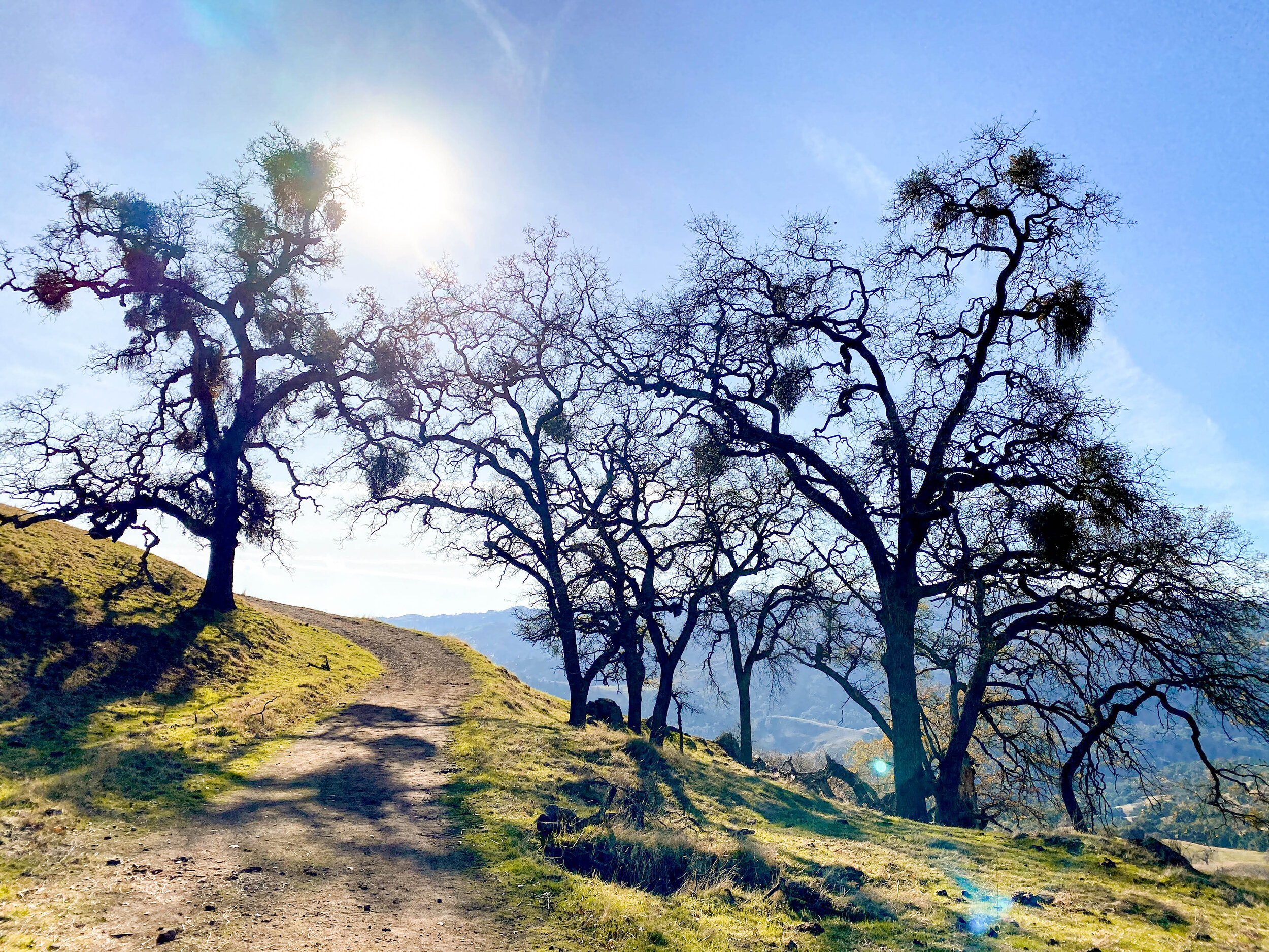
Flag Hill Trail is a steep climb on a sparsely shaded path lined with mistletoe-laden oaks. We spotted some chatty goldfinches and woodpeckers along the way. Since we arrived early, we had the entirety of Flag Hill Trail to ourselves, a stark contrast to some other parts of the park.
As you climb, the terrain becomes progressively more bare. Look down every once in awhile to see the small speck of the parking lot from where you came. As a bonus, once you’ve reached Flag Hill Road, you’ve probably passed by at least a few adorable cows who graze freely across the park.
You may think you’ve conquered the mountain at this point, but prepare for a second climb up Vista Grande Road. It’s well worth it - the vista is quite grande indeed.
Take a moment to soak in the views at the conveniently-placed bench on Eagle View Trail. You’ll soon briefly descend into a beautiful, shaded ravine with a shallow creek crossing.
Indian Joe Creek Trail is a lovely, whimsical, fairylike conclusion to the hike. It’s decorated with green grass and large, leafy oak trees, a welcome sight in the summer and fall when the hills are largely brown and dry. You may encounter a few river crossings on this trail in spring or early summer when water levels are higher.
For a shorter, albeit more crowded, hike in the same park, see our Canyon View to Little Yosemite hike. Feel free to combine the two hikes if you’d like a longer, all-day option to explore the park more thoroughly.
A satisfying descent down Indian Joe Creek Trail surrounded by peaceful oak grasslands. Perfect for a picnic, too.
Those bird nest-like clumps are mistletoe that have made themselves at home on these trees. A romantic hike for sure.
A very tiny (and winded) Andy after he decided to run this last stretch of Flag Hill Trail.
MORE INFO
Some Reminders
There are a few trails that seem to extend from the parking lot, but to take the correct one, remember to first take the footbridge across the creek, and then hang a right.
These trails are… let’s just say… well-fertilized. Be careful not to step into any cow pies! Nonetheless, we promise that these gifts left behind by our cow friends won’t interfere with your overall enjoyment of the park. That said, please admire the cows from a distance for your safety.
Please keep the park beautiful by cleaning up after your dog!
Helpful Resources
Official park page and trail map here.
Good Eats
There are limited dining options in Sunol, but the park is near both Fremont and Pleasanton which have plenty more. We tried The Kebab Shop in Fremont. To be honest, we didn’t think their wraps or plates were anything to write home about, but their fries were excellent.