MOUNT DIABLO
Eagle Peak to Summit and Mitchell Canyon | Clayton, CA
★★★★★
A base-to-summit rocket launch of a climb up one of the tallest, most iconic peaks in the Bay Area. Hundred-mile views on a clear day.
Last hiked 4/15/18
Length: 13.0 mi.
Gain: 3260 ft.
Type: Loop
Difficulty: Strenuous
Crowds: Moderate
Dogs: No


THE RUNDOWN
Mount Diablo is as much a force to be reckoned with as it is a stately work of art, sculpted 3,800 feet high and chiseled with immaculate detail. Here, the minuscule, like vibrant spring wildflowers, and the grand, most notably the summit’s famous views, coexist to form a stunning dynamic guaranteed to impress. This hike’s a doozy, and you’ll thank yourself for pushing through!
Parking is located past the fee station on Mitchell Canyon Road in Clayton. We recommend arriving before 9am to secure a spot and to reserve enough time for the long but rewarding hike ahead.
Note: The photos on this page are from two separate hikes (April 2016 and 2018).
Park Hours: 8am to sunset
Fees: $6 per vehicle
Trailhead: Mitchell Canyon Road Trailhead at Mitchell Canyon Parking Lot
Restroom: Yes
We took a clockwise loop starting from the Mitchell Canyon Visitor Center. Map generated via caltopo.com.
This trail traverses two peaks: Eagle Peak and Mount Diablo’s summit.
Park at the Mitchell Canyon Visitor Center, past the fee station on Mitchell Canyon Road.
STEP BY STEP
↑ Proceed to Mitchell Canyon Road. The trailhead is at the southern end of the parking lot.
← Shortly after, make a left onto Oak Road.
Tip: Last time we checked on Google Maps, there's no actual sign for Oak Road. Follow the sign that says "To Mitchell Rock Trail".
↑ Continue onto Coulter Pines Trail.
→ Stay right onto Eagle Peak Trail.
← At the next fork (near Twin Peaks), stay left to continue on Eagle Peak Trail.
↑ Continue onto Bald Ridge Trail after passing Meridian Ridge Road.
→ Turn right onto North Peak Trail.
→ Turn right onto Summit Trail right before hitting Summit Road. Follow signs for the summit or visitor center to reach the top.
↑ From the visitor center, walk past the picnic benches and overflow parking area to proceed onto Juniper Trail.
→ Juniper Trail tees into Deer Flat Road. Make a right onto Deer Flat Road.
→ Stay right onto Meridian Ridge Road.
← Stay left onto Mitchell Canyon Road, which takes you all the way back to Mitchell Canyon parking.
The trails around Mitchell Canyon are surrounded by calming oak woodland.
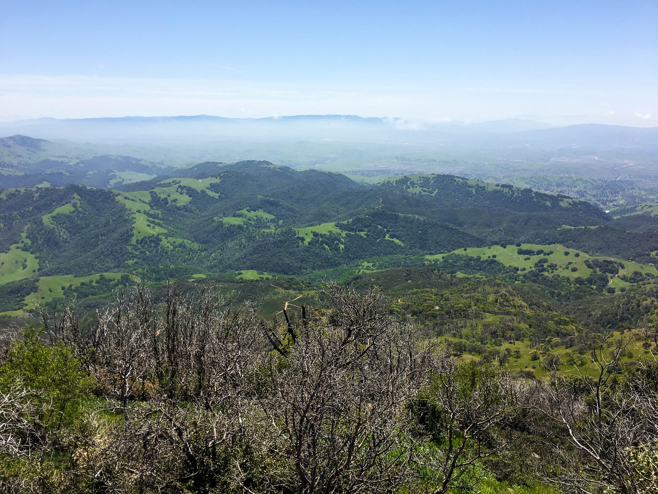
Long, steep ridge trails = plenty of vista points. This is the view from North Peak Trail near the summit.
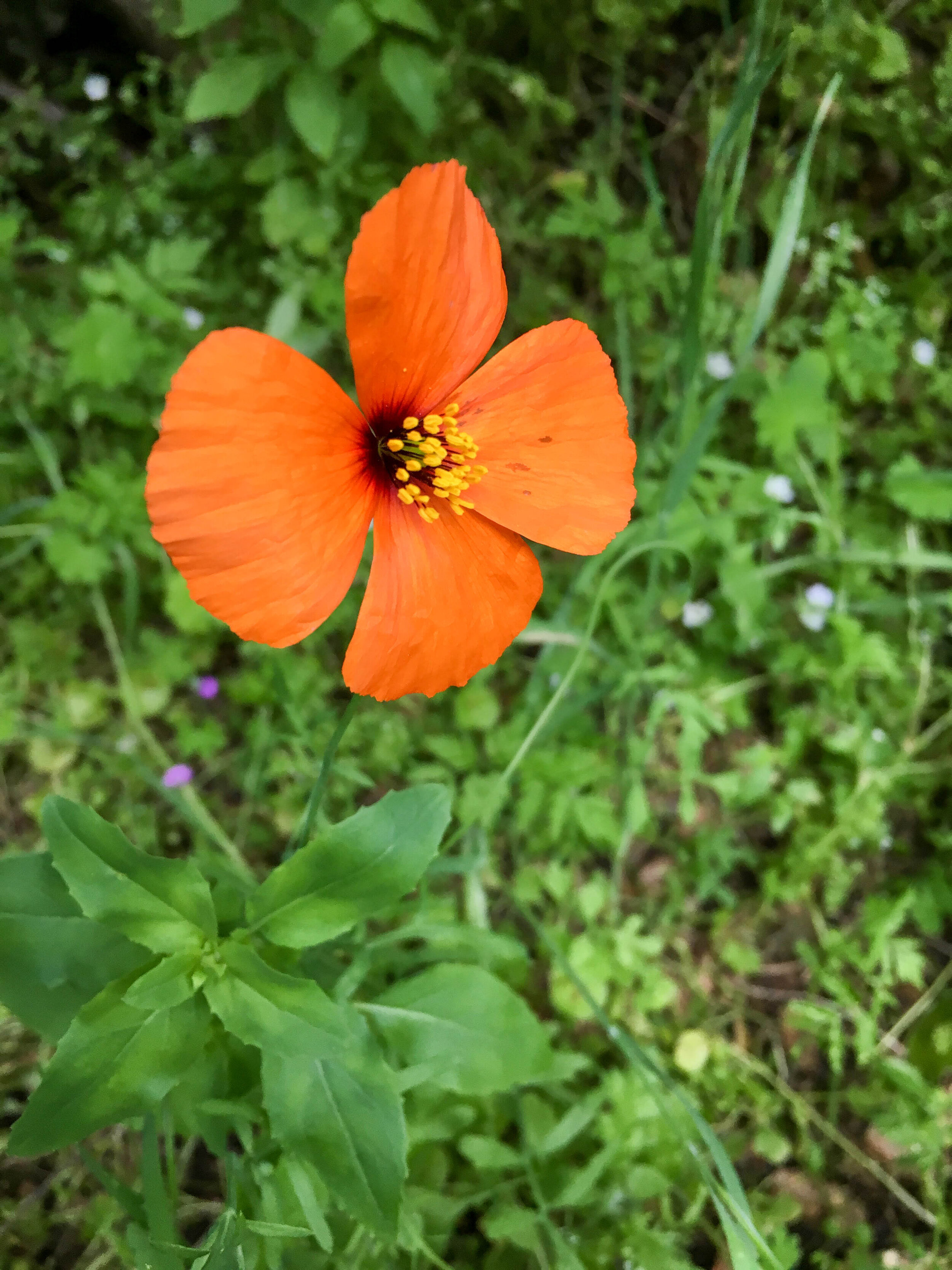
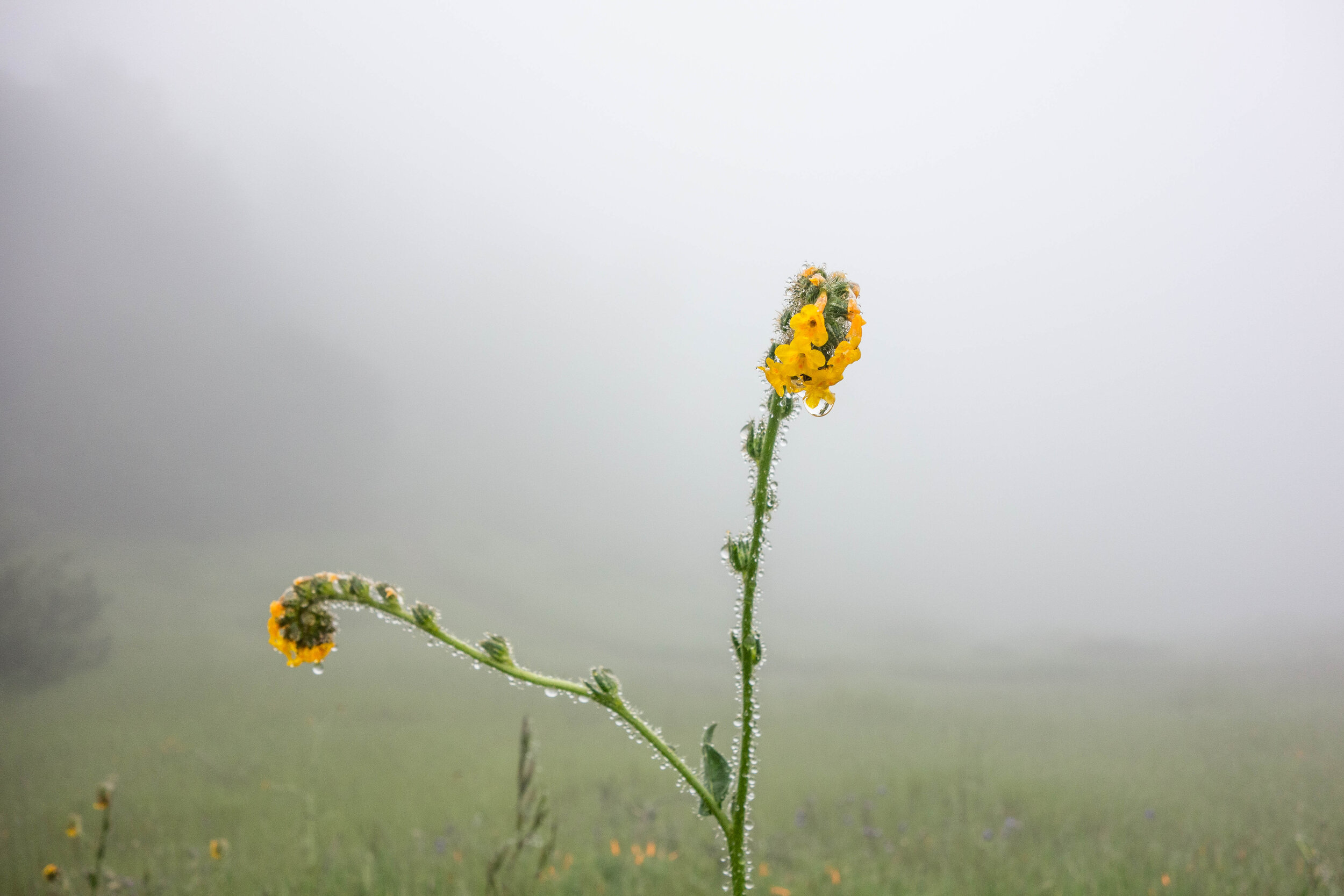
Spring in Mount Diablo is always a colorful occasion, providing a stark contrast to the bare, rocky landscape found near the summit.
MUSINGS
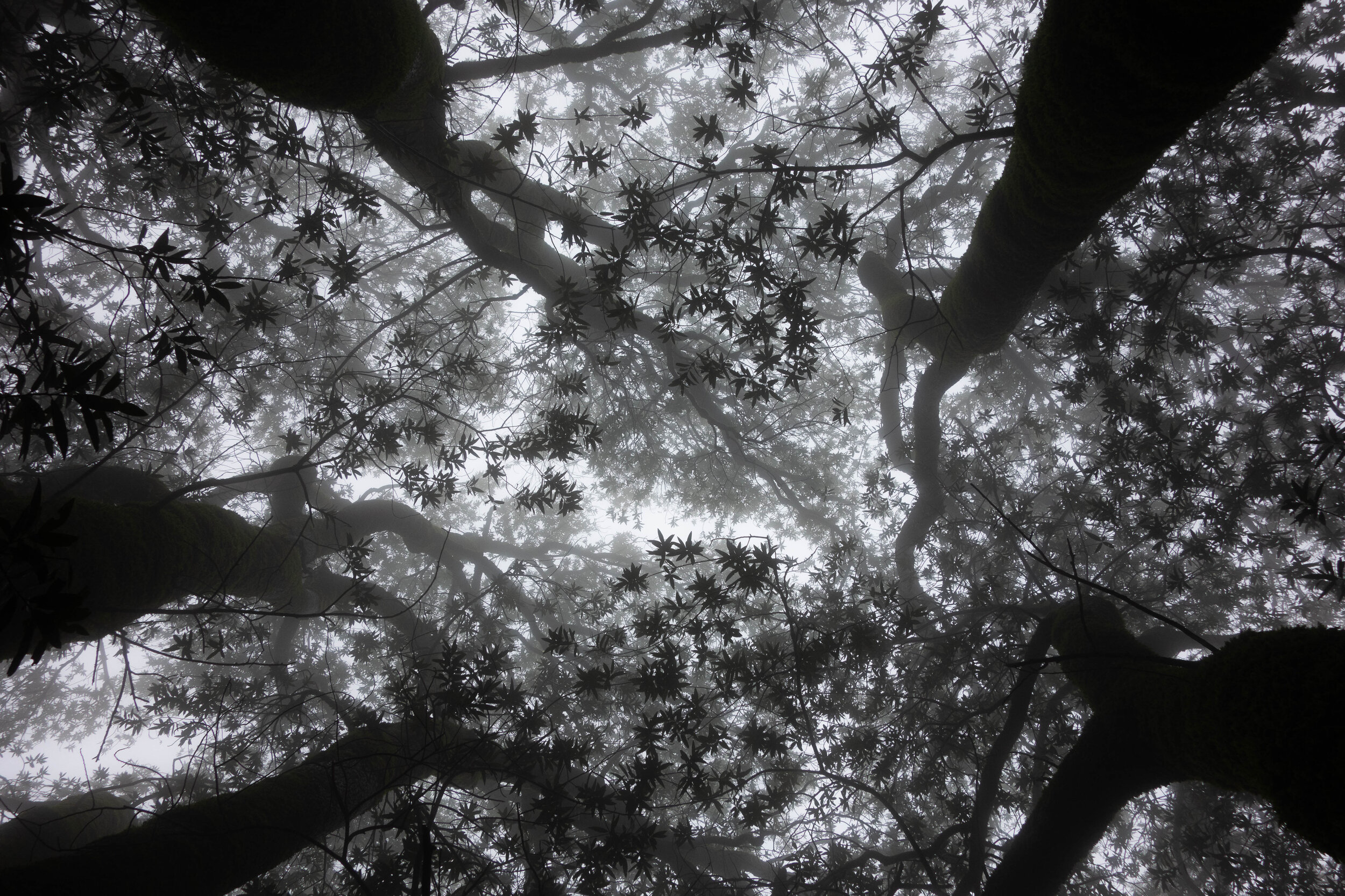
This hike made such a lasting impression on us not only for how satisfyingly grueling it was (hello sore legs!), but also because we were constantly surrounded by exceptionally dense fog on our first visit in 2016. Our trek started out drizzly, muddy, and admittedly a little miserable, but we quickly appreciated the ominous beauty of the dense white haze. Since we couldn’t see into the distance, everything — from massive oak trees to peaceful meadows — was a surprise, only appearing before us when we were within 50 feet of them. The following descriptions won’t do it justice, but we hope you’ll go out there and experience this place for yourself. We also highly recommend hiking this trail in early spring to early summer — the ideal window for stunning wildflower blooms, picturesque greenery (think Windows XP background), and pleasant weather to boot.
You’ll first embark on a warm-up on Oak Trail before climbing up Eagle Peak, where you’ll already enjoy the sweeping views of nearby Clayton, Concord, and Walnut Creek. Straight ahead and up 2.5 miles is the summit of Mount Diablo, so here’s your chance to picture your goal the rest of the way there! Yes, it’s daunting. Yes, you’ll conquer it.
Along the way on Bald Ridge Trail and North Peak Trail, don’t forget to take breaks and enjoy the scenery. There are plenty of vista points overlooking steep canyons and distant suburbs.
At the summit, you’ll feel like you’re on top of the world. Check out the visitor center (currently closed due to COVID-19) where you can step foot on the official tip of the mountain and learn more about the historical and ecological significance of the area. On a perfectly clear day (best the day after a strong storm), you can literally see across the state, from the Golden Gate Bridge to the snow-capped Sierra Nevada, and 40 of California’s 58 counties. Some claim you can even see Half Dome with binoculars.
The summit is also an excellent place for a well-deserved snack or lunch. We recommend spending at least a good half an hour up here to soak in all the views.
As you meander down Juniper Trail and Deer Flat Trail, you’ll encounter some of the most giant oak trees you’ve ever seen, which create a nature-saturated descent, guaranteed to delight.
Finally, Mitchell Canyon Road takes you along tranquil Deer Flat Creek and is a perfect, relaxing way to end the hike. There’s a chance you’ll be accompanied by turkeys and deer, grazing on the surrounding hills. Not quite Narnia, but pretty close.
You can tell we really like wildflowers.
Coulter Pines Trail on a gorgeous April morning.
This tree arch earned high marks.
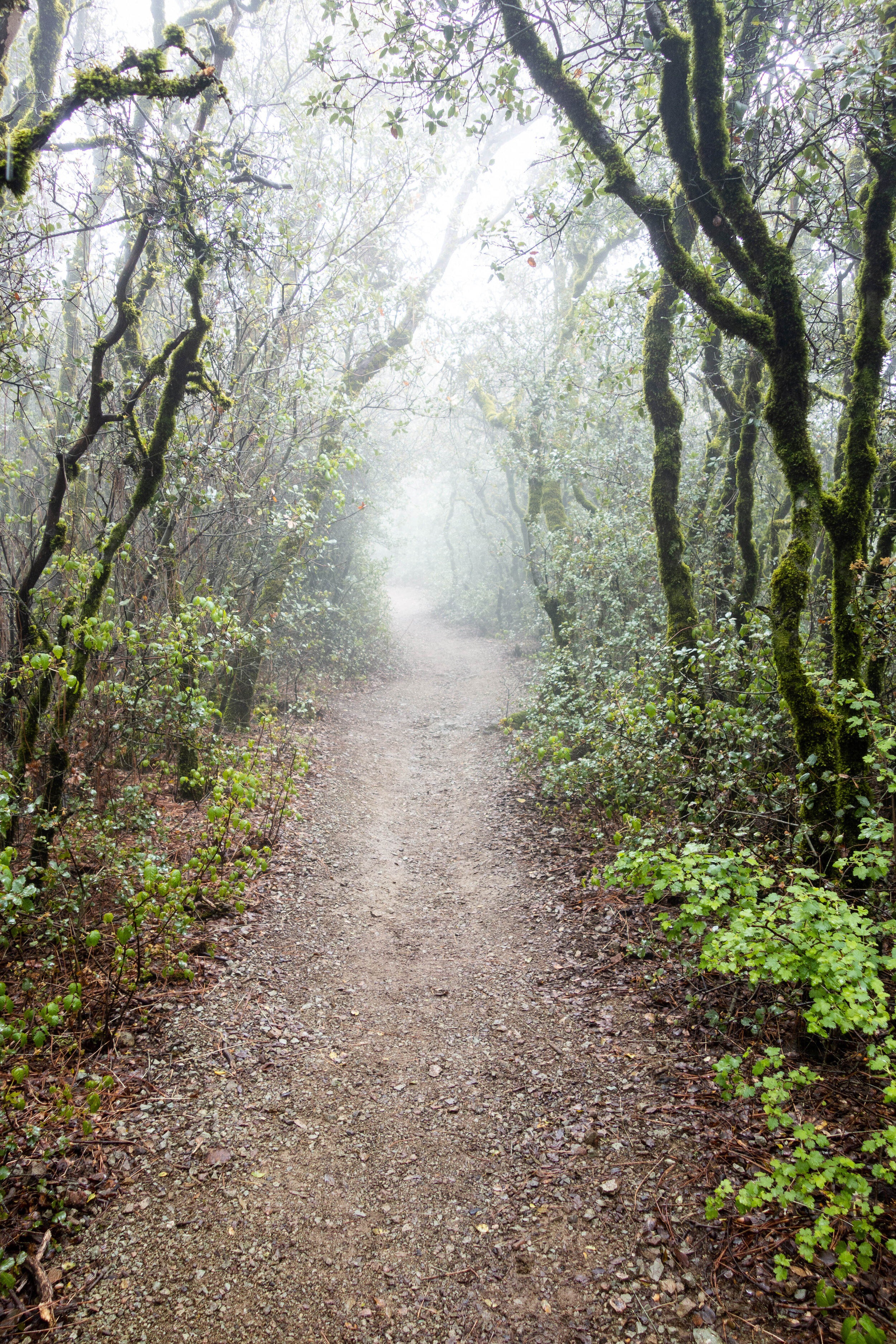
Into the foggy abyss we go...
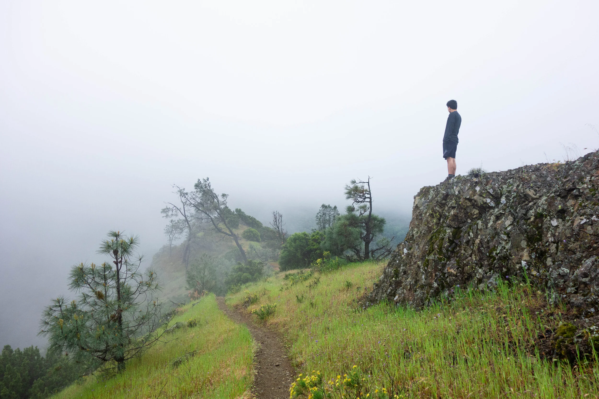
The climb to Eagle Peak was a tough morning workout, but surrounding peaks quickly reminded us of the greater challenge ahead.
Edible miner's lettuce along Deer Flat Creek.
This massive California bay laurel grove near the Juniper Campground took our breaths away.
MORE INFO
Some Reminders
Make sure you're in good shape before this hike. If you're unsure, we recommend first training on a few other easier hikes to make this one more enjoyable.
Check the weather before you head out. Summers can get dangerously hot, and portions of this trail have sparse coverage. We advise against hiking in temperatures over 85°F.
Bring at least 3 liters of water. This is a long, strenuous hike, and the last thing you want is dehydration.
Helpful Resources
Mount Diablo State Park official page here.
If a base-to-summit hike is not your cup of tea, there are plenty of other enjoyable hikes in the area! Redwood Hikes lists two other hikes that explore Mount Diablo's foothills. You could also make your car do all the work and drive to the summit (summit parking currently closed due to COVID-19) via the North Gate or South Gate entrance.
Good Eats
Babalou’s Mediterranean in Walnut Creek sells delicious wraps, plates, and kabobs. We’d go back often if we lived nearby.
If you’re returning to the Oakland area or San Francisco, stop by Vik’s Chaat in Berkeley. Specializing in Indian street food, it’s easily one of our favorite eateries in the Bay Area.